Friends of NOAA at AMS

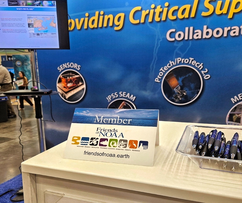
Friends of NOAA (FoNOAA) was present at the recent American Meteorological Society’s Annual Meeting, held January 29-February 1, 2024 in Baltimore, MD.  FoNOAA member organizations showcased their work and ties to the meteorological community, including intersections and arcs with NOAA.  In the Exhibit Hall, there were FoNOAA table top cards at several booths.  A big “thanks” to member institutions for promoting FoNOAA at AMS.  These interactions at AMS and other FoNOAA events are all part of FoNOAA leadership’s effort to broaden ties between FoNOAA and NOAA at all levels — which we believe will foster greater understanding of NOAA’s mission, and outline areas where FoNOAA can have meaningful impact. 

NOAA’s 2023 Arctic Report Card

NOAA has released information about the 2023 Arctic Report Card that can be found at:

Report Card 2023 – NOAA Arctic.

ARCTIC ESSAYS

More frequent extreme weather and climate events are transforming the Arctic, yet resiliency and opportunity lie within diverse partnerships

The Arctic is increasingly warmer, less frozen, and wetter, with regional extremes in weather, climate patterns, and ecosystem responses. Centering locally and internationally-focused partnerships, long-term observations, and equitable climate solutions provides Arctic communities and nations as well as society-at-large with information and mechanisms to cope with a rapidly changing Arctic.

In the air

  • Average surface air temperatures for the Arctic in the past year were the sixth warmest since 1900.
  • Summer surface air temperatures were the warmest on record.
  • Summer high-pressure systems brought warm temperatures, widespread melting, and exceptional rainfall volumes across the Greenland Ice Sheet.

In the ocean

  • Sea ice extent continues to decline, with the last 17 September extents (2007-23) as the lowest on record. Sea ice extent was 6th lowest in the satellite record, since 1979.
  • August mean sea surface temperatures show continued warming trends for 1982-2023 in almost all Arctic Ocean regions that are ice-free in August. Mean sea surface temperature over regions between 65° N and 80° N is increasing at a rate of ~0.9°F (~0.5°C) per decade.
  • Arctic regions, except for the Chukchi Sea, Beaufort Sea, and Canadian Archipelago, continue to show increased ocean phytoplankton blooms, or ocean primary productivity, with the largest percent change in the Eurasian Arctic and Barents Sea.
  • Since the end of the Last Glacial Maximum, rising sea levels have inundated terrestrial permafrost surrounding the Arctic Ocean, resulting in nearly 1 million square miles (~2.5 million square km) of subsea permafrost that is at risk of thawing. International research collaboration is needed to address critical questions regarding the extent and current state of subsea permafrost and to estimate the potential release of greenhouse gasses (carbon dioxide and methane) as it thaws.

On the land

  • North American snow cover extent set a record low in May 2023, while snow accumulation during the 2022/23 winter was above average across both North America and Eurasia.
  • Heavy precipitation events broke existing records at various locations across the Arctic and the Pan-Arctic precipitation for 2022-23 was the sixth highest on record.
  • On 26 June 2023, Summit Station, Greenland reached 32.7°F (0.4°C) and experienced melt for only the fifth time in its 34-year observational history.
  • The Greenland Ice Sheet lost roughly 350 trillion pounds (156 ± 22 Gt) of mass from 1 September 2022 to 31 August 2023 because discharge and melting exceeded accumulation.
  • The 2023 circumpolar average peak tundra greenness, which is the overall vegetation, including plants, shrubs, and trees taking over grassland and tundra, as measured by satellite, was the third highest in the 24-year record.
  • In Finland, peatland restoration and rewilding demonstrate a globally relevant climate solution of carbon sinks and point to a need for replication across impacted sites. Rewilding requires partnership, recognition of Indigenous and community rights, and the use of Indigenous knowledge alongside science to succeed and avoid replication of past inequities.

Nunaaqqit Savaqatigivlugich: Working with communities to observe the Arctic

  • The Alaska Arctic Observatory and Knowledge Hub (AAOKH) works with a network of coastal Indigenous observers to document long-term and holistic observations of environmental change and impacts in northern Alaska.
  • Recently, Indigenous observers have noted sea ice loss, warmer air and ocean temperatures, changing wind patterns, and increased intensity and frequency of coastal storms that contribute to flooding and erosion.
  • Indigenous observers also document local-scale impacts of environmental changes to community and cultural infrastructure, traditional harvests and activities, and travel safety across the land and sea.
  • Applying and centering Indigenous perspectives and observations of Arctic change in decision-making can lead to more inclusive, equitable, and community-led responses.

Divergent responses of western Alaska salmon to a changing climate

  • Western Alaska salmon abundance reached historic extremes during 2021-22, with record lows for Chinook and chum salmon (81% and 92% below the 30-year mean, respectively) and record highs for sockeye salmon (98% above the 30-year mean).
  • Salmon are maturing at smaller sizes. Since the 1970s, Yukon River Chinook salmon have decreased an estimated 6% in mean adult body length and 15% in fecundity, or ability to produce offspring, likely exacerbating population declines.
  • Salmon population declines have led to fishery closures, worsened user conflicts, and had profound cultural and food security impacts in Indigenous communities that have been tied to salmon for millennia.
  • Changes in salmon abundance and size are associated with climatic changes in freshwater and marine ecosystems and competition in the ocean. Changes in predators, food supply, and disease are also likely important drivers.

A recording of NOAA’s stakeholder briefing on the 2023 Arctic Report Card can be found at:

Arctic Report Card Stakeholder Briefing

2023 NWS End of Year Recap

From the NOAA Office of Organizational Excellence

Dear NWS Partners – 

Your collaboration is critical to our mission, and we want to keep you updated with the latest happenings at NOAA and the National Weather Service! Here are some recent noteworthy items we wanted to share:  

1. Transformation Roadmap for 2023 

Released earlier this year, the NWS Strategic Plan set the direction for becoming a more nimble, flexible, and mobile National Weather Service by 2033. On October 26th, NWS launched its Transformation Roadmap, outlining our path to achieving these strategic goals. 

Click to read the Transformation Roadmap

2. AI Language Translation Project

For the past 30 years, NOAA’s NWS has provided manual translations of weather forecasts and warnings into Spanish. Now, the agency has a new tool to provide more accurate, efficient, and equitable service.  

Through a series of pilot projects over the past few years, NWS forecasters have been training artificial intelligence (AI) software for weather, water, and climate terminology in Spanish and Simplified Chinese. This effort was supported by the House Appropriations Committee in NOAA’s fiscal year 2023 Congressional budget.

Click to read more about the AI Language Translation Project

3. Fifth National Climate Assessment (NCA5)

In case you missed it, the recording of NOAA’s National Climate Assessment Stakeholder Briefing is now available. This congressionally mandated, quadrennial report brings together hundreds of experts from federal, state, and local governments, as well as academic, non-profit, and private sectors. The report is a roadmap to a better future through science-based information, data, and real-world examples of ways to reduce greenhouse gas pollution and develop resilience strategies. 

Click here to view the full assessment. 

4. New Orleans Radar Relocation

The WSR-88D Radar located in Slidell, LA will be relocated to Hammond Airport by early 2024. 

The KLIX WSR-88D Radar move to Hammond, Louisiana will provide a drastic improvement in radar scanning strategies for areas of southeastern Louisiana that currently have poorer radar coverage.

Click here to read more about the WSR-88D radar relocation

5. RFI to Inform National Plan for Civil Earth Observations

A request for information (RFI) posted on the Federal Register last week. The White House Office of Science and Technology Policy (OSTP) requests public input and seeks information from stakeholders to inform the development of the congressionally mandated National Plan for Civil Earth Observations.

Click here to view the RFI and provide comments on the first draft of the 2023 National Plan.

6. Winter Campaign

The NWS Winter Safety Campaign officially launches today! Developed by the NWS Communications Division, the campaign consists of social media graphics, videos, and more to help build a Weather-Ready Nation. 

We encourage all NWS partners to use and share this content as appropriate. Most of the campaign content can be found on the Winter Safety website. This public-facing website and its materials can be shared with anyone interested in messaging weather safety.

Click here to find all Winter Safety content so that you can spread the word!

7. See you in January!

Stay tuned for a Save the Date message for the NWS Partner Engagement Event at the 104th American Meteorological Society Annual Meeting in Baltimore, MD!

Thank you for your partnerships and have a great weekend!

Cindy Elsenheimer
Partnership Engagement Lead, NWS Office of Organizational Excellence

NOAA’s National Climate Assessment

A recording of NOAA’s National Climate Assessment Stakeholder Briefing is now available.

Under Secretary of Commerce for Oceans and Atmosphere and NOAA Administrator Dr. Richard Spinrad, Chief Scientist Dr. Sarah Kapnick, and Senior Advisor for Climate Ko Barrett, along with six authors discuss key takeaways from their chapters, including the newly added chapters of economics and social science and justice. 

You can find out more about the assessment with the following resources: 

Planet Federal

planet.com

Planet is an integrated aerospace and data analytics company that operates history’s largest fleet of Earth-imaging satellites, collecting a massive amount of information about our changing planet. Planet is driven by a mission to image the entire Earth every day, and make global change visible, accessible and actionable. Founded in 2010 by three NASA scientists, Planet designs, builds and operates over 190 satellites, and develops the online software and tools that serves data to users. Decision makers in business, government, and within organizations use Planet’s data and machine learning- powered analytics to develop new technologies, drive revenue, power research, and solve our world’s toughest challenges. 

Biden-Harris Administration announces $80 million through Investing in America Agenda to improve flood prediction capabilities

From NOAA Communications:

Funding supports NOAA’s efforts to upgrade the National Water Model and expand Flood Inundation Mapping services

September 27, 2023

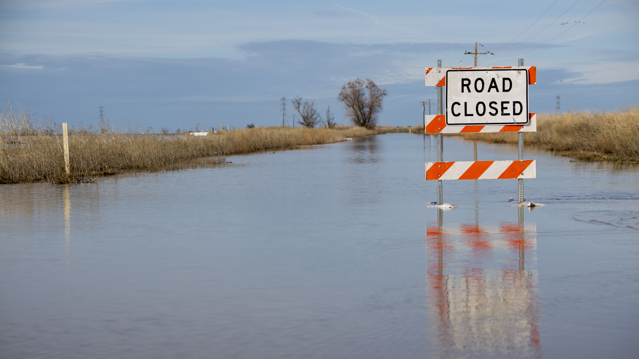
San Jose road closed due to flooding at the intersection of Highway 20 near Williams, in Colusa county, California. An atmospheric river storm dumped heavy rain and snow across Northern California. Photo taken on January 12, 2023. Credit: Kenneth Mames, California Department of Water Resources.
Road closed due to flooding in Colusa County, California, following an atmospheric river storm that delivered heavy rain and snow across Northern California. Photo taken on January 12, 2023. (Image credit: California Department of Water Resources)

Earlier this month, the Department of Commerce and NOAA’s Office of Water Prediction awarded the Next Generation Water Prediction Capability contract to Raytheon, an RTX Business. The $80 million, four-year contract will transform water prediction by enabling rapid deployment of advanced water models to provide coupled, continental scale, operational coastal and inland flood forecasting and inundation mapping services. 

“Floods can have devastating impacts across the country, harming local economies, damaging infrastructure, and putting lives at risk,” said U.S. Secretary Gina Raimondo. ”This investment, made possible by President Biden’s Investing in America Agenda — a key pillar of Bidenomics — will give first responders, emergency managers and the public better, fast information about where, when and how our communities will be affected by flooding.”

The contract is for the development of two capabilities:

  • A new Water Resources Modeling framework supporting future versions of the National Water Model with state-of-the-science hydrologic and hydraulic model formulations, and
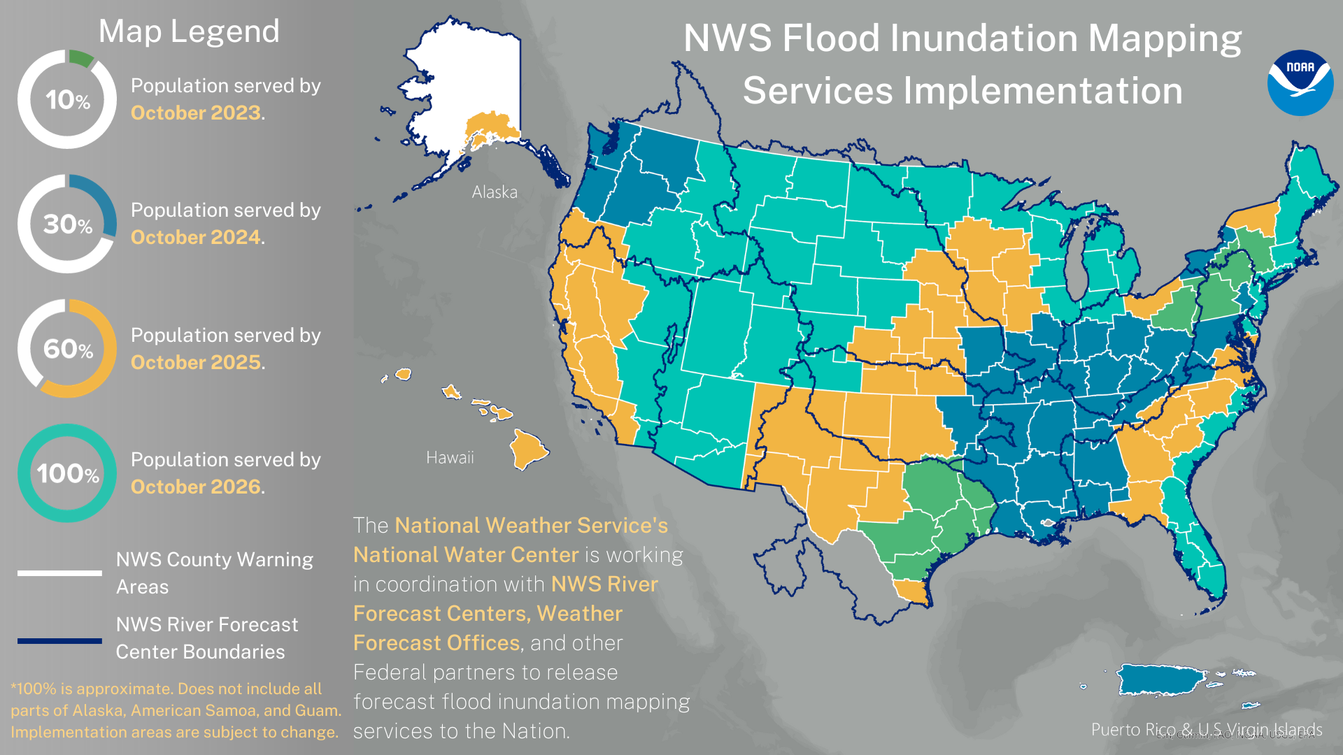
  • Near real-time, high spatial resolution flood inundation maps and services for nearly 100% of the U.S. population leveraging both forecasts from National Weather Service River Forecast Centers and operational guidance from the National Water Model.
Image showing NOAA’s new experimental flood inundation maps that are currently available to 10% of the population, shown in green. These services will expand to nearly 100% of the population by 2026. Credit NOAA
NOAA’s new experimental flood inundation maps are currently available to 10% of the population, shown in green. These services will expand to nearly 100% of the population by 2026.  (Image credit: NOAA)Download Image

The contract also requires Raytheon to deliver an integrated, high-resolution hydrographic, topographic and bathymetric geospatial dataset underpinning both the National Water Model and Flood Inundation Mapping service capabilities, and a cloud-hosted Optimization and Evaluation Environment to configure the new National Water Model and Flood Inundation Mapping services. 

These new capabilities will create a pathway to operationalize the new models and techniques developed by the Cooperative Institute for Research to Operations in Hydrologyoffsite link, and ultimately will enable broader community engagement as envisioned in NOAA’s Weather, Water and Climate Strategy. In addition to running models that predict streamflow, floods and inundation, the new Water Resources Modeling framework also will provide an avenue to deploy improved models of drought, soil moisture and water quality into operations.

“NOAA’s National Weather Service is taking flood forecasting to the next level,” said Dr. Michael Morgan, the Assistant Secretary of Commerce for Environmental Observation and Prediction. “This project is expected to enhance our ability to identify and communicate potential flooding and pass that life-saving information on to emergency managers, decision makers and the public.”

The agency also awarded $7.4 million, of which $1.7 million is Bipartisan Infrastructure Law funds, to GAMA-1 Technologies to develop the Hydrologic Visualization and Information Services system in the cloud to serve as the platform for dissemination of high-resolution flood prediction services to the nation. Please visit the Bipartisan Infrastructure Law website to learn about other current and future funding opportunities.

Media contact

Maureen O’Leary, NOAA Communications, Maureen.Oleary@noaa.gov, (202) 578-5257

Parymon Corporation

Parymon Corp is a woman-owned, HUBZone-certified small business providing exceptional  environmental, technical, and professional services. Parymon Corp offers a breadth of services that support the U.S. federal government, private sector, and others. Our experienced, diverse, and passionate team is committed to effecting positive change in the world.

The Parymon Corp team’s mission, expertise, and experience align with many NOAA goals across multiple NOAA line offices. Our core service areas include: oceans & coasts; climate & weather; telecommunications engineering; communications, education, & planning; program management & professional support; and, information technology support.

Parymon Corp has supported NOAA for more than 10 years. We are experts on topics as varied as protected resources, telecom engineering and wireless network design, fisheries, resource economics, aquaculture, information technology, renewable energy, marine and coastal conservation, climate change, and day-to-day program and project management. We are experts in technical communications, meaningful public engagement, and strategic planning and we engineer and lead these processes to be equitable, participatory, and scalable.

Parymon Corp delivers tailored, durable solutions to many of today’s environmental, technological, and business challenges. We are thrilled to be able to support NOAA in numerous capacities and geographies, including as a member of Friends of NOAA. 

NOAA seeks public comment to inform more equitable climate service delivery

from https://www.noaa.gov/stories/noaa-seeks-public-comment-to-inform-more-equitable-climate-service-delivery?s=03

Input from across sectors will build on existing efforts to make NOAA’s climate data, information, science and tools more accessible and inclusive

July 20, 2023

Children playing in water fountain.
Children playing in water fountain. (Image credit: Getty Images)

More than ever, communities across the country are facing the impacts of climate change, from prolonged drought to hazardous flooding and widespread heat waves. In 2022, there were 18 separate weather and climate disaster events in the U.S. with losses exceeding $1 billion each — totaling over $165 billion — and recent Census Bureau data show that disasters displaced more than three million Americans in 2022 alone. There have already been 12 separate billion dollar disasters in the first six months of 2023.

A changing climate has implications for the safety, well-being and resilience of our nation’s communities — especially our most underserved. That’s why today, NOAA has released a Request for Information (RFI) that seeks feedback on its delivery of climate data, information, science and tools, or “climate services,” to help ensure that this vital information reaches all U.S. communities in a way that is accessible, inclusive and usable. 

The RFI also focuses on how NOAA can increase capacity and access to climate services for climate preparedness, resilience and adaptation planning in historically underserved communities — including tribal and Indigenous communities. The RFI will also address how the agency can better include indigenous and local knowledge in its climate services. 

These communities face disproportionate impacts from climate change, which can be compounded by long-standing and systemic economic, social, civic and environmental inequity. Yet, historically, these communities have had the least access to resources that would help them to advance their community priorities, build resilience to climate-related disasters and adapt to a changing climate, and avoid significant future damages.

Building on NOAA’s Climate Equity Roundtablesregional pilots and efforts to build a Climate-Ready Nation, this RFI will gather critical feedback that will be used to develop an Action Plan designed to:

  •  Make NOAA’s climate services more accessible, understandable, usable, inclusive of the social and economic impacts of climate change and capable of addressing complex hazards. 
  • Build capacity for and support users of all disciplines and backgrounds, particularly historically underserved communities and tribal communities, by expanding science literacy and successfully applying climate services to science-based decisions about climate risk and resilience. 

The RFI will be open for a 60-day comment period and will close September 21, 2023. NOAA is especially seeking feedback from the public health, affordable housing, food security and economic development sectors, communities with environmental justice concerns, tribal and Indigenous communities and other historically underserved communities that NOAA aims to better and more fully support.

Written or recorded comments can be emailed to climate.input@noaa.gov. Comments will not be accepted via phone. Commenters are encouraged to join regional and community-specific listening sessions to engage with NOAA staff and provide comments in real time. 

Find more information about the RFI and listening session registration at the following links:

Woodwell Climate Research Center

Woodwell Climate Research Center

Woodwell Climate Research Center (Woodwell) was originally founded as the Woods Hole Research Center in 1985. Our world-leading research and education helps individuals, communities, corporations, and nations understand the realities of climate change, recognize the impact it is having everywhere on our planet, and embrace the urgent action needed to safeguard the future of life on Earth. Our renowned researchers investigate how human activities are affecting the flow of carbon and water—key climate factors—through the world’s most critical ecosystems, from the Arctic to the tropics. Together with our global network of partners, we generate breakthrough insights into the risks we face and the just, e ective solutions we can develop.

We work with partners, stakeholders, and government officials in more than 20 countries across six continents—from the Arctic to the Amazon, and D.C. to D.R.C. We engage throughout the research process to ensure that our insights can be integrated into real-world decision- making. This approach has delivered outsized impact for over 35 years.